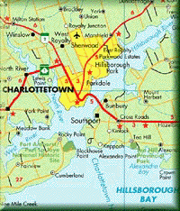
click here to download the free pdf map of Prince Edward Island
LOOKING TO THE FUTURE
Good.iWare headed by Yuri Selukoff has created the best pdf reader for the iPhone and iPad, GoodReader. You can now have an iPhone map or iPad map as pdfs by purchasing GoodReader and purchasing and importing my maps into your iPhone or iPad.
Good Travels, Angus
We have joined PayPal to provide the means for you to make a donation for these maps. We are asking for $2.00 to $5.00 per map used would really support our efforts.
We are also offering for sale a version of the Prince Edward Island map without the advertising banner for $5.00 (click below to pay for this file using Payloadz's automated payment and file transfer system)
and a print enabled file for $10.00 (click below to pay for this file using Payloadz's automated payment and file transfer system)